Monday, April 20, 2015

Black Beauty Maiden Voyage

Last week, the missing part for my new bike finally arrived and the shop was able to complete the build. My friend Pavel had sent me a spy photo of my bike mid week, just to make me count days till Saturday.


 I arrived at Passion Trail Bikes  early for my fitting session. This was actually the very first time I was fitted professionally to a bike. Adjusting the cleats made a noticeable difference and few mm here and there immediately changed how I felt on the bike.

The bike was not yet completed - the parts that had to be adjusted based on the final fit needed work. Since I drove a long way from Pleasanton, I was prepared: a six pack of Pilsner Urquell did the job and I was promised it would be finished as a priority. I had couple of hours to kill in Belmont. Instead of sitting at Starbucks and surfing the web or writing a blog or some other useless activity, I decided to visit Crystal Springs Cross Country course, a place we used to live next to and a place where I ran many times. I ran here at 5AM in dense fog, in the afternoon at 80F, or more likely in the afternoon after work at 55F with the fog rolling in. One reason I love the Bay Area weather is no matter what temperature you are at, if you don't like it, just move a little bit in space. I never thought much about these trails, they were just convenient, but the real outdoors opens to the west of Canada Rd.

Walking the full three miles of the course, I realized how much my perception has changed since we moved. There were great views of the reservoirs and the ridge behind. Springtime adds colors and fresh looks to many places around here.

In one hour it took me to circumnavigate the three loops of the course, I experienced several sights that made me think I was in the backcountry, not on the edge of overpopulated and frantic urban area. First, I saw a kestrel hovering above the grassy slope, nothing so unusual, except the bird was completely white. I guess albino kestrels exist, they are just not seen too often. As I was admiring some baby head size mushrooms among the wildflowers,

I came on a sunny part of the trail just in time to meet this guy:

At least three feet long and pretty thick in the middle, the rattle up and clearly ready to put up a fight if disturbed. I stayed at a safe distance (I heard rattlesnakes can strike to about three times the distance of their body length, but how long was this one since it refused to make a straight line to be measured?).
Just as I was thinking how many runners this snake looked at from its hiding place, these trails being pretty busy sometimes, I got the call from the shop that the bike was ready for pick up.


After the ransom changed hands, the shop mechanic weighed the bike: 27.3 lbs on the official shop scale! That's about the same (perhaps a few ounces lighter) than my old Mojo 26. After that, I loaded the bike on the roof rack and drove to the trails while having an anxiety attack about not securing the bike to the rack properly. Do you guys also drive at freeway speeds with an open window and your hand on the fork attachment just to feel your bike is safe up there, or is it just me?
I chose the Sanborn county park trails in Saratoga, specifically the John Nicolas trail, since it is not very technical, but offers a long climb, followed by a long descent on a trail built purposely for mountain bikes. This trail was ideal to fine tune my position, suspension pressures, positions of levers on the handlebar etc. Shortly into the climb, I confirmed my previous impressions: the bike is very stable thanks to its long wheelbase, held the line very well and with every pedal stroke it almost wanted to surge forward from beneath me. The 30T chainring proved to be just about right even on few steeper pitches, but for really steep and technical terrain I would have to switch to 28T (have one).
After reaching Skyline, I continued north to the Indian rock formation, enjoying the narrow singletrack which I had for myself in the afternoon hour. On each short downhill section, the bike picked up so much speed - no doubt big wheels are faster than the 26".

But the real fun started after turning around and eventually going down the switchbacks of John Nicolas trail. Just feathering the brakes and gradually allowing myself to hit the ramps at more and more speed- this bike really wanted to be in the air, despite the long chain stays, the front lofted easily and there was no nosedive tendency which I feared the most on all my previous bikes. I think this is also partly due to dropper seat post, I used the middle position for the downhill and tried the slammed down position for the final steepest fire road section. So at this point, my first impressions are very positive, I feel this bike has two personalities: an XC racer going uphill and a big rig when pointed down.


Tuesday, April 14, 2015

The slowest century

In the past, which now seems like a really distant past, I often enjoyed riding my road bike fast. Fast as on letting off the brakes on some of our winding, steep roads. Highway 9, 84, Page Mill Road (although I preferred to climb here), Kings Mountain Road, Panoramic Highway etc etc., there is no shortage of descents in the Bay Area where Strava downhill speed records are often contested. It not only seems foolish to me today, it seems downright dangerous (I'm getting old). When I remember riding down Tioga Pass on the last day of the 2012 Sierra Tour on my old aluminum Giant bike and seeing 54mph on the Garmin display, I shiver.
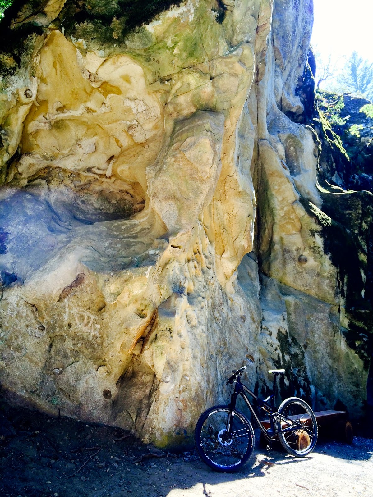
So, my desire to ride fast is gone, but I still like to believe that I could ride long distances if I wanted to. You know, slow, in a touring mode, on a bike equipped with racks and panniers and low gears. Since my new mountain bike is still undergoing the last stages of a custom build, I planned to ride on roads. Some of the most scenic backroads in the East Bay are along the Mt. Hamilton century course. When I suggested this ride to my biking buddies, everyone came back with some excuses except Jill, who decided that a 100 mile ride was the right way to recover after a 100 mile run. She joined me for this ride on her carbon S-Works road bike, while I rode my Ti hardtail in a test touring setup, identical to this one.
I am not going to describe the beauty of canyons along Mines Road,  Mt. Hamilton or Calaveras Road in the spring, since I did not take any photos. I was focused on pedaling, trying to maintain a decent speed on flats, ignore the pain in my legs and resisting the urge to stand up and push hard in order not to be left too far behind.
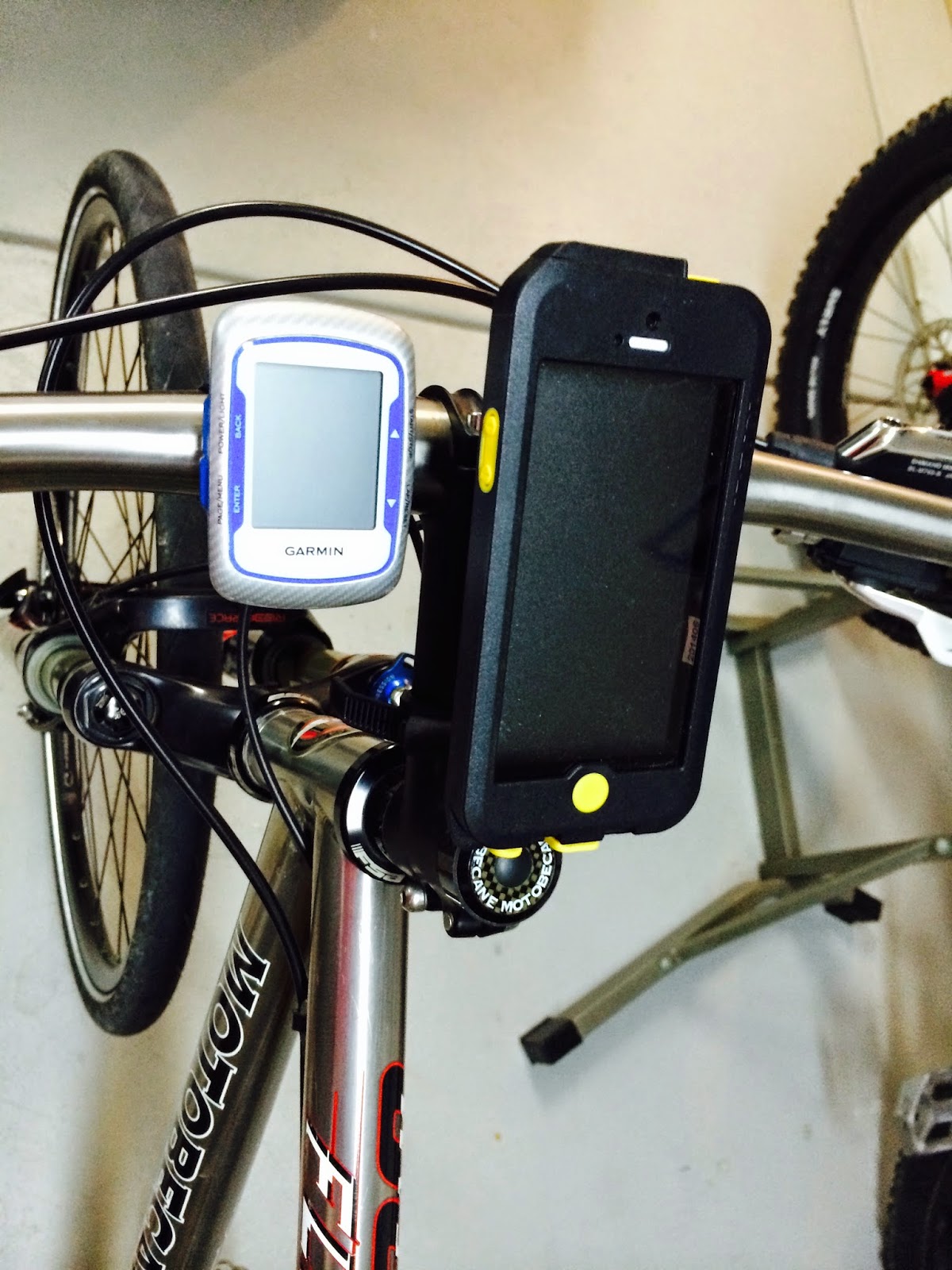
I was also testing couple of items on my bike to see if they would be suitable for longer, let's say three day touring. The rack and panniers were tried before, and again proved to be sturdy, stable and reliable, albeit on the heavy side. My new Serfas rechargeable tail light, very bright, with strip LED, did not last the whole day in a low intensity blinking mode, so it is not good for long or multiple days with limited charging options. I also installed a new Topeak iPhone case on the handlebars, with the intent of using my phone instead a paper map, thanks to the Gaia GPS app.

This is a sturdy, waterproof case which has pretty clever mounts for both the stem and the steerer tube cap. The iPhone 5 fits inside just perfect, with no wiggle. The screen is less sensitive to touch and does not work with full finger gloves - the iPhone screen does, although just barely.


I chose Gaia GPS after reading reviews online, mainly for its offline mode and the ability to download OSM maps of any part of the world for free, then saving the map areas in the phone memory for use outside of cellular signal. I think this feature will be very useful for touring in Europe, where I always turn cellular data off and use public WiFi. The question remained if the phone battery would last for a day just powering the screen, GPS and a compass. The screen shot above shows a gpx track of the route, found and downloaded from an online activity tracker, displayed on the previously saved offline map. I did not use Gaia for route tracking, I had my Garmin Edge 500 for that. I liked the continuous scroll of the map while riding, the only issue was after zooming in, the map orientation defaults back to static mode and you have to hit the small cross hairs symbol twice to orient it into the direction of moving and start scrolling.
I set the app into the OFFLINE mode, but noticed that my phone stayed connected to 4G or LTE signals whenever available, so obviously the cell antenna was not turned off. After close to nine hours of use, I got a low battery warning few miles from home, but this was exactly what I tried to avoid - depleting phone battery if you have just one device for navigation as well as communication is not acceptable on solo tours in remote areas. I will need to read the user manual more.

All together, my equipment worked, I learned about its weaknesses and my tired legs spun the pedals all the way back to the starting point, for a total of 104.3 miles. During the whole ride, I felt really slow and wondered if it was the bike that was too heavy, or me not riding such a distance for almost two years. After uploading the Garmin data, I could compare my times on 100+ mile rides that I recorded in recent years:


As you see, this was my slowest ride in the 100-107 mile range and the third slowest average speed. With 8800 ft of climbing, this century is a tough ride and considering the time gap between my last years of being in shape and today, it is not too bad. If I can keep collecting data points for the graph showing correlation between my age and speed on century rides for the next ten or fifteen years, I won't mind proving that the correlation indeed exists.