I believe I grabbed the last reservation slot for the season opener ride by the Evergreen Mountain Bike Alliance. The ride took place on Saturday at the Joe Watt Canyon near Thorp, WA. The weather being sunny for what seems now like a forever, and temperatures climbing towards high eighties over the weekend, I was ready for the long (2 hrs) drive to the eastern side of the Cascades. I was curious for multiple reasons: I have not been east of Snoqualmie since we moved to Seattle, I wanted to meet EMBA riders, who do an awesome job in servicing the mountain biking community here by maintaining the best Trails wiki page, organizing group rides, maintaining trails and building new ones, and of course, tons of biking advocacy.
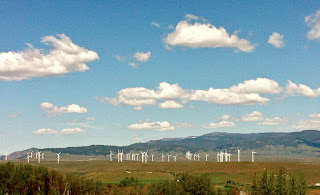
The trail head was just off I-90 on a high plateau, the views were so different - open space, big sky, wind mills and snow capped mountains.
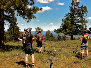
A group of ten riders gathered at the parking lot and off we were, anxious to hit the technical trails. This of course resulted in the fast group, who did not know where we were going, getting lost soon, but Bob the ride leader soon herded his sheep and yelled clear route signals at us all. He camped in the area the night before, went to preride the trails and even removed bunch of obstacles (!).
Many of the trails seemed like freshly cut, sometimes the super narrow ribbon of singletrack disappeared and we free-rode over roots, rocks, grass and loose volcanic soil. The sun baked the backs of our necks, but the 3000 ft elevation and a nice breeze made the hot day very enjoyable. There was a strong pine and sage (I think) smell in the air, which reminded me strongly of John's and mine tour through Southern California almost exactly a year ago.
We had lunch on a green meadow next to an old cattle corral and a clear creek before some more grueling climbing on fire roads. Most of the soil was very dry and lose, littered with fist to head sized rocks, which made the climbs really strenuous and the downhills sketchy (for my ability). The final downhill was a blast and when I looked over my shoulder at the bottom of the descent to see what's on the picture below, I almost endoed in a rain rut Bob warned us about.
Back at home, with my bike, myself (including corners of my eyes and nostrils) full of dust, I looked at the GPS track and realized that we rode "only" 11 miles, my legs felt fried more than after Kokopelli Day 3. Was it worth driving 2x 100 miles for this ride? Absolutely! Bunch more photos by Anthony Cree are here, now we only need a map, as Igor pointed out.


No comments:
Post a Comment