Wednesday, December 28, 2011

Peninsula to Point Reyes - Part III

Sorry for the confusion: there have not yet been parts I and II of this bike ride. This was supposed to be a leg # 2 of my long planned one-way bicycle trip from mid-peninsula (Belmont) to Olema, at the foot of Point Reyes. The distance (estimated >100mi) and the fact that I am planning on riding as many trails along the way as possible, requires a long day.
St. Stephen's day (December 26) is definitely not a long daylight time of the year, but the recent dry and sunny weather here prompted me to plan and ride which was supposed to be a second half of the planned long ride, starting at the Golden Gate bridge and finishing in Olema.
Due to a late start (OK, I arrived at the GG bridge and realized there were no bike shoes nor helmet in the trunk, I swear, that has never happened before!!!), the plan was changed to start at the Muir Beach overlook on Highway 1, just north of Muir beach.


The weather looked great, despite a dense fog down on the peninsula, as well as some fog in the distance up north. The overlook is a convenient place to start a ride, or take a break (water, toilets), with a great view of the coastline.


I entered the Cost View trail and started the climb towards Pantoll. The trail was a singletrack! I did not know there were any left at Mt. Tam. The trail is steep, rocky and rutted by horse hooves, so not a nice singletrack  by any means, but OK. The views of the coast and Hwy 1 got nicer:


and my via point - Mount Tamalpais ahead:


The track widened before the Pantoll station, where I did not stop, crossed the Panoramic highway and continued onto Stagecoach fire road, which is even paved for the first part. Here, the trail is a wide, smooth surfaced double track, so one can put the hammer down and enjoy the views.
It seemed like the West Point Inn came too soon, and another push along the Old Railroad Grade rd. took me to the visitors center just below the East Peak of Mt. Tam.


From here, I descended on Eastridge road and turned right (north) onto West Ridge Blvd, a.k.a. "Seven Sisters". Just after the second sister (or sixth?, depends from where you count...), the road disappeared in a fog bank.


I reached the Bolinas Ridge trail head shortly after, entering redwoods forest here.


This was about half way through this ride, with 11 miles to go to Sir Francis Drake Blvd near Olema. This trail is known to be muddy in the winter, mainly due to the redwood trees collecting the moisture, but since we did not get a drop this December, the surface was great, cushioned by redwood needles. The trail follows the Bolinas ridge, but it is by no means flat. It is a roller-coaster ride with redwood sections alternating with steep, rocky, chaparral covered climbs, where one can look both towards the coast as well as inland.
For this part of Bolinas ridge, I was in the woods completely alone, the only sound was my tires cracking some fallen branches, this could have been the Enchanted Forest.


With about five miles to go, the trail leaves the woods and enters cattle pastures, grass covered hills, and becomes badly rutted, I assume by the cows eroding the area when it gets muddy. At this point, the temperature dropped to mid forties under overcast skies and I was getting tired by getting bounced on those sods which seemed to be placed in a perfect checker board pattern.


But I could see Tomales Bay from here and knew there would be a warm room, fire in the fireplace, hot shower, beer and some local raw oysters awaiting me couple of miles ahead. That all turned out to be the case at the Point Reyes Seashore Lodge.


So the Leg number 3 was just 26.5 miles in 2:45 hrs, but enough on this beautiful winter (!) day. Leg one is Belmont to San Francisco, leg two Golden Gate bridge to Muir beach over the Marin headlands. I hope this whole trip will come together next year.  Garmin track here.

Monday, November 28, 2011

Low Key Hill Climb Series 2011

On Thursday, The Turkey Day, the 2011 nine weeks long uphill race series called "Low Key Hill Climbs" culminated with the last and longest uphill battle to reach the summit of Mt. Hamilton. The races took place every Saturday morning at various roads around the Bay Area. The races had several things in common: volunteers who did a great job in herding all the nervous roadies at the start and finish lines, the racers themselves (the usual Bay Area roadie crowd, whatever that means), beautiful local small roads, all pointing quite sharply upwards, and a rain free weather. One thing that none of the races featured, despite the name, was anything low key. Sure, there were no large number plates, no podiums, no prizes and no speeches, but these were fiercely competitive events, with the top guys and ladies achieving quite unbelievable times and ascend rates. Overall results are posted to a great detail here.


As for my "goals" for these races, I thought these may be a good opportunity to keep my legs in shape during the fall season, when days get shorter and weather may make it harder to get out and ride. Secretly, I also thought it would be nice to be able to do all nine weeks. There were also several locations I have never ridden before (Sierra Road, Palomares, Mix Canyon, and yes- Bohlman etc. Rd).


To make the nine weeks-long story short, I managed to participate in all nine events, thus earning a membership in the exclusive 100% club. It was not easy, I suffered on several climbs mightily and was reminded on weekly basis of how many super fit people live in this area. My face burned on the sun exposed section of Page Mill Road in a 75F weather, I froze my ass off on the way down Highway 9 after the climb, bonked twice on Bohlman and Mix Canyon, and got soaked wet and punctured on the way down from Mt. Hamilton. I also got to meet my friend Martin whom I raced with at the BCBR, and his family, in Vacaville.


So, by mere participation, I earned slot # 71 out of total 326 riders who scored, and finished second at the Endurance Award, which I interpret as someone who has accumulated the longest time (my overall time was 38 minutes shorter than the winner's)! Here is a summary table with some numbers:


Hill Montebello Sierra Rd Page Mill Bohlman-
Kittridge-
On Orbit
Palomares Mix Canyon Highway 9 Kings Mountain Mt. Hamilton Overall
feet
climbing
1940 1759 2221 2010 1062 2257 2128 1540 4399 19316
distance 5.3 3.66 8.62 4.44 4.56 4.91 6.67 4.32 18.4 60.88
grade 6.95% 9.14% 4.89% 8.61% 4.42% 8.74% 6.05% 6.77% 4.53%
points 89.71 83.63 91.02 83.5 85.76 79.56 80.71 84.2 87.65 438.33
time 39:56:00 35:05:00 47:52:00 41:04:00 24:03:00 45:54:00 46:40:00 30:51:00 103:21:00 414:46:00
mph 7.96 6.26 10.81 6.49 11.38 6.42 8.58 8.4 10.68
fph 2915 3008 2784 2937 2649 2950 2736 2995 2554

Sunday, November 20, 2011

Belmont Bicycle Bridge Open

The pedestrian / bicycle bridge over Highway 101 in Belmont finally opened on Saturday November 19. From what I read online, the idea was first proposed about ten years ago, construction approved and planned by city of Belmont in 2009, first scheduled to open in June 2011 and after one false broadcast on the web, opened in November.
This bridge crosses Hwy 101 just north of the Ralston Avenue overpass and connects to the Bay Trail at the Belmont Sports Complex on the eastern side, and drops you off onto Ralston at Hiller St. west of 101.
It will allow access to the Bay Trail at Oracle, as shown on the picture below, with possible (even though not very easy) access to San Carlos Caltrain and points south.


On the Belmont side, entering the bridge means veering off Ralston and making a left turn onto Hiller, then crossing Ralston at the pedestrian crossing light signal, which should work fine. On the way west, there will be couple of blocks of heavy traffic streets with no bike lanes until NDNU. As usual, the merge of the off-bridge lane onto the street crosses the right turn only lane, so one will have to watch for mindless drivers here:


Overall, the bridge is big and ugly, as many things in this country are, and if it really cost $8.8M (this figure is not from a reliable source), I think the whole Belmont and San Carlos could have bike lanes painted on every street and perhaps even some bike-only traffic signals installed, as they do it in Holland, for example. But it is great that the bridge is here, since it will open a possibility for me to ride to work on chilly winter days when the San Andreas trail is too cold, and ride home after dark instead taking the train.  
Foster City Patch has a report and a slide show here.
Here is a shaky iPhone video of my inaugural bridge crossing:


Monday, October 31, 2011

Jill Homer Inspired Ride

Last week, I read a post on the Jill Outside blog about her awesome long ride through the Santa Cruz Mountains and the Pescadero coastal area, and Jill's description made me realize that numerous possibilities for this style of riding (a mix of trails and backcountry roads on a mountain bike) is what makes cycling here in the Bay Area so great. For reasons explained in more detail here, I took my 29er hardtail for an outing with a plan of combining rides I have done in the past, with no exact idea on how long or difficult this ride would be.

I started late so I kept my Magicshine light on the handlebars. The first part of the ride was all pavement, although if there were more pro biking officials at San Mateo county offices, it would not have to be:
  • Hallmark to Canada Rd. - could be Sheep Camp Trail, at least there is the paved Ralston bike path
  • Canada to Olive, Greer to Huddart Park - could be on the dirt path paralleling Canada Rd, horses only path alongside Olive and Greer
  • Huddart Park service road to Kings Mountain Rd - plenty of great trails in Huddart leading to the Bay Area Ridge Trail on Skyline, all closed to bikes
  • Kings Mountain Rd to Skyline, on Skyline to Purissima Creek OSP parking lot - paralleled by the BART, thought of riding it but the NO BIKES sign just seemed too ominous
Finally on dirt! At Purissima, I descended the Whittmore Gulch trail, with its nice views of the coast:


Down in the cool redwoods the trail has been smoothed and repaired at spots prone to get muddy.

I left the preserve at the Purissima Road and continued onto Lobitos Creek Cutoff and Tunitas Creek Rd. These are small roads with little traffic winding through some farmland, I guess there isn't much chance for trails around here.
I refilled my Camelbak at the Bike Hut, which I think is a fantastic idea, not just because their honor system is really cool, but also because it makes even roadies to stop for a friendly chat, something of a habit among mountain bikers but a rare occurrence with the Lycra clad crowd.

The fog bank was looming along Highway One and sure thing, once I started climbing up along the coastal cliffs towards Stage Rd, temperature dropped to 60F, visibility turned low, but the cars passing at 70 mph did not seem to care. Luckily there is a wide shoulder here.
From here on, it was Stage Rd down to San Gregorio country store, crossing Hwy 84, up over the ridge and a nice downhill to Pescadero. The temperature dropped again here and there were no cars on this road, just a couple of motorcycles and lots of cows around. I did not stop in Pescadero either, knowing there was water in Memorial Park. I got to the group sites at Memorial Park via the Wurr Road and looked for a water source, since my Camelbak was empty and I had a long climb ahead. It took me a while to locate a working water faucet but the water here was ice cold and fresh.

The next six miles or so on Old Haul Road were fast and totally enjoyable on the big wheel bike, with fast rollers and a little of an incline. I decided against taking the Camp Pomponio trail since it was getting late, and continued to Portola Redwoods State Park, where there is a new bridge in place of the old stream crossing. The park was deserted on late Sunday afternoon as I started the steep climb on the Park road towards Alpine Road. This climb is a grinder but I felt good and alternated between spinning a granny and pedaling standing at the middle chain ring. I reached the upper parts of Alpine Road around the golden hour.

 
From Alpine road, I took my favorite Ancient Oaks trail at the Russian Ridge preserve to Ridge Trail and after a sweet fast singletrack crossed the Skyline onto Clouds Rest. The dirt trail riding then continued on Alpine trail and ended at the pavement of Alpine Rd. At the bottom of Alpine Road, there was a chance to cross into Windy Hill preserve on some more dirt doubletrack, which I did. Having ridden about 65 miles at this point, I dreaded the flat section through Woodside and Canada Road, but for some reason (could be the tailwind), I spun the pedals almost effortlessly at comfortable 17-18 mph. The sun went down behind the western ridge and I turned my lights on on Canada Rd. Reaching the gate to the Sheep Camp trail, I quickly pulled over, shut the lights off, gulped a gel and rode up the dirt trail towards 280 and the Belmont cross-country course. I did not feel too good about poaching a trail closed to bikes, but this is a gravel service road used by pickup trucks and the only reason why it is closed to bikes is due to the fact that this is a sensitive water management area. No damage done and after the home stretch climb, I felt a little dizzy getting off the bike after 8 hours, 80 miles and 8100 feet of vertical. GPS track here.

Halloween Bike Ride Tribute to Brave and Strong Women


Halloween Bike Ride Tribute to Brave and Strong Women in My Family
In Czech Republic, the last weekend of October, or the first November weekend, are the days to remember our dead. Families get together at cemeteries, since often times, multiple members of one family are buried on the same graveyard. This is also a good time to catch up with your relatives after the visit to the graves, over hot coffee and strudel, on a typically foggy and drizzly autumn day. I remember carving a pumpkin lantern as a kid with my grandfather, but that part of tradition is I believe lost after many years of communist-organized night vigils at fallen Red Army soldier’s monuments, even though these included paper lanterns.
This year’s “Dusicky” weekend was especially hard for me not only for not being able to visit my gone ancestors, but also because I talked briefly to my aunt who is on her deathbed in an oncology hospital in Prague. I felt her suffering but was helpless, so I did what I do when I need to clear my head: go for a long bike ride. During this ride, particularly when riding along the foggy coast between the Tunitas and Pescadero creeks, I kept thinking about women in my family and realized that many of them were / are really strong. But at the same time I thought being strong to endure periods of hardship is one thing, being brave to make life decisions which include totally uncertain future consequences is quite another.
So images of my clan’s women, sometimes quite blurred, floated in my mental vision while I pedaled. In no particular order, I thought of their life stories and realized each of them did some things remarkable, so here is the account:
My grandma Miluše went to live in Paris in the 1930-ies to perfect her French and to have an affair with a Serbian Royal army officer. During the World War II, the night after the Heydrich assassination in Prague, she thought about marking her two little children so that they could be found after the war, in case the Gestapo would take her and her husband. At the end of her days, when her mind and body were betraying her, she kept on soldiering through without a complaint.
My other grandma Ludmila stayed in Prague during the Nazi occupation when other Jews fled, with her husband in a camp and two hungry kids, one sick with TB. She survived the Soviet occupation of 1968, unlike her Holocaust survivor husband, whose heart could not take another loss of freedom. Her many years before she passed away were a pure torture, bedridden in pain, she kept her mind sharp by reading newspaper and sarcastically commenting on the world’s nonsense. Her sister Máña, about whom I actually don’t know that much, raced cars and motorcycles in the 1930-1940-ies, when not that many women would even consider driving.
My auntie Lída shared her life and love with another woman, which must have taken a good deal of courage during those 40 years of communism, when LGBT lifestyles were criminalized. She also showed so much strength in her recent battle with cancer. My mom Hana decided to join the Prague Spring movement in 1968, not as an idealistic teenager, but a young, married woman with two kids. She ended up bearing the consequences of her decision for the next twenty years when her career was limited and she had to face daily repressions of the regime. Today, she is not afraid to hike the Alps with thirty year olds and learn computer skills. My sister Tamara was brave to ditch her stable but boring job, she quit teaching others how to design things and instead went ahead and started her own design studio, while raising two teenage daughters on her own. My wife Markéta is strong to run and finish marathons. Mostly, she was brave to have left all her previous life behind and move to a foreign country with me, and brave to having embarked on a long and uncertain path to becoming a psychologist, after more than twenty years of not enjoying life sciences so much.
So I am not exactly sure why none of my male ancestors or relatives made the picture on the Halloween ride yesterday (they certainly deserve it), but there you go girls: you make the rockin’ world go round.

Tuesday, October 4, 2011

Low Key Hill Climb No.1 and an Introduction to Coe

The first in the nine-week long series of Low Key Hill Climbs took place Saturday at Montebello Rd. This used to be my after work road ride to a nice vista point with great views of the Silicon Valley. I tested my climbing legs last weekend on Kings Mountain Rd, OLH and Crestview in one ride and felt good. But this ride did not go well for me and I struggled for the first half of the climb and was able to catch my breath on the second half but just barely. I "improved" my 2009 time by 3 sec to a miserable 39:56. But the scenery and the view from the top was as nice as ever.


On Sunday, I finally got myself to make the long(ish) drive to the Henry Coe State Park. I have been thinking about riding at this park the whole summer long, but a lack of companion for this remote place, weather being too warm etc. were among the reasons why this ride always got postponed. With weather forecast threatening rain this week and also reading on mtbr.com about several people's crazy idea of riding 140 miles and 29K vertical at Coe pushed me to venture there. I decided to ride just a basic, introductory loop from the park headquarters, starting on a nicely flowing singletrack (Frog flat) to a fireroad climb to Frog Lake, then taking Middle Ridge downhill to China Hole. The downhill trail could be fun if it was not for my first cautious time there, I was on my brakes most of the time in order to avoid surprises at switchbacks. The trail surface was pretty loose and I fought for traction at places, probably due to too much tire pressure as well as my rear Nobby Nic due for replacement. It was obvious that this trail was not a purpose-built MTB trail, rather a typical trail used by horses with a V-shaped trough, as well as of-camber turns.
The dry river at the bottom of the canyon was interesting, but the hike a bike section on Creekside Trail to China Hole less so.


At China Hole, I met a chatty backpacker, who was trekking the park on a three day trip and was probably sick of being alone at this remote place. He also told me about meeting the group of six ultra-endurance riders attempting the Coe Everest Challenge.


The climb back to my car on China Hole Trail was nice, very sunny but with a nice breeze coming from the west, and very nice views of the ridges around.
So as a first glimpse of what Coe has to offer, this 13.7mi ride was perfect. I will be coming for more of Coe, since it will stay open for 2013 and hopefully beyond.

Monday, September 26, 2011

Euro Cycling Bits

On a recent trip to Europe, I visited three places which all had something to do with bicycling, despite the fact that my time there was completely off the bike.

Stop One: Prague, Czech Republic. Clearly, the "Lance effect" of the new XC World champion Jaroslav Kulhavy aka "Kulhec" is huge. The August World Cup XC race in Nove Mesto na Morave attended 30,000 spectators (according to the Czech cycling magazine Peloton.cz ) and 250,000 people watched it on TV! That's as if 600,000 people came to see a MTB race in the USA (based on country populations). And of course, another Czech Michal Prokop is again (for the third time) a World champion in 4-cross and few other Czech female and male racers placed among top ten.

I saw many people riding bikes around Prague, mostly hardtail mountain bikes fitted with racks, lights and fenders. The city bikes seem to be absent, but a creative use of bikes for advertising is definitely not:


Stop Two: Paris, France. Nothing cycling- worthy here, except the fact that I rode in a taxi by the place where the Tour de France finishes every year:


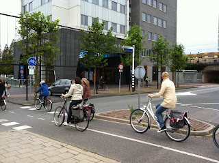
Stop Three: Leiden, The Netherlands. Very nice university town with the standard Dutch biking culture. Dedicated bike lanes with their own traffic lights, everybody riding in their street clothes, no helmets, talking to each other, talking to their cell phones etc. 


All Dutch street bikes are pretty much the same and there are so many of them everywhere. The bike parking and storage does not seem to be an issue:


And surprisingly, for a small country and a historical town with narrow streets and sidewalks, bikes and bike racks occupy a dominant space, literally and figuratively speaking:


We live in one of the most cycling friendly places in the USA, the Bay Area weather allows us to ride all year long, most people can afford really nice bikes, yet the car society tradition continues and the best American MTB athletes do not place above the 20th rank in the UCI events. As with so many other things, mountain biking was invented here but perfected elsewhere.

Thursday, September 15, 2011

Mini Tour de Peninsula on 9/11

The great thing about mountain biking in the Bay Area is that there are lots of other people seeking new routes and trying to push the limits. They also share their routes online or organize low key events, such as this 2010 MTB Tour de Peninsula. I have been itching to try to ride the route, but have been always turned off by the distance (80 mile+) and the fact that there were long road sections.
On Sunday, September 11, I have decided to try a shorter (lots shorter!) version of the ride, starting at the Windy Hill OSP parking lot.
The day did not start too well, I broke my favorite Garmin Edge 500 GPS, don't ask how. So here is a "manual" ride recap:
1. Spring Ridge Tr up to Skyline: steep, sunny, hot, 30 min climb.
2. Skyline (road) to Ripley Ranch Rd.
3. Ridge Tr to Hawk Tr: windy, cold, rain clouds rolling in, a few drops of rain.
4. Hawk Tr: great views from this narrow ribbon of singletrack
5. Ancient Oaks Tr to Bay Area Ridge Tr
6. Cross Skyline just north of the vista point
7. Clouds Rest Tr, Meadow Tr to Alpine Tr
8. Alpine Tr to Page Mill Rd, cross the road to the new White Oaks Tr
9. White Oaks Tr: this newly cut trail is much better than the old rutted trail!
10. Skid Road Tr to Skyline, cross Skyline, across the parking lot
11. Sunny Jim Tr to Horseshoe Pond
12. Tree Farm Tr
13. Chestnut Tr
14. BART
15. Peter's Creek Tr
16. Ward Rd intersection to Hickory Oaks Tr
17. Across Skyline onto Saratoga Gap Tr
18. Saratoga Gap: hot dog, water, found a slow leak in rear tire and decided to ride on it after 100 pump strokes
19. Retrack to Peter's Creek Tr and across Skyline to Grizzly Flat Tr, pump up
20. Steven's Canyon Tr uphill
21. Steven's Nature Tr to White Oak Tr
22. Cross Page Mill Rd onto Alpine Tr, pump up
23. Alpine trail to Alpine Rd
24. Ridge Tr connector back to Windy Hill parking lot
25. 64.7km = 40.2 miles, 5 hours moving time, 6 hrs total.

Compare the blue 80+ mi MTB TdP route with mine in red, so it looks like I need 12 hours and lots more training to ever try the full route.


Thursday, September 1, 2011

GPS Frustration

I think the Garmin Edge 500 I use is the greatest component on my bikes. No sensors, no wires, no wheel magnets, no wheel size calibrations. I like the fact that you can move a single bike computer among several bikes. I like it's accuracy and also the fact that it is small. I don't need a map on a small, hard to read display. I like to study maps on paper or online and plan my routes to the point where I remember most important turns. And there is the iPhone, in case one gets lost and is lucky to catch any At&T 3G signal (a rare occasion west of I-280).
So where does my frustration come from? I guess as many others have done, I sometimes forget to stop the Garmin at the end of a ride. This must be the old cycle computer habit. Unlike the magnetic sensor computer, the GPS does not care that your front wheel is not moving, as long as you are moving, or your bike mounted to the roof rack si moving, it keeps acquiring the waypoints.
OK, so I come home, plug the Edge into the Mac and see that my ride now has added 57.3 miles at an average speed of 60mph. Marketa says "Why do you care how many miles, vertical feet, calories etc you recorded? Did you enjoy the ride?" and she is of course totally correct. But I just cannot log such a track! And not logging anything at all for a four hour sweaty hard ride is not an option, either.
So what's the solution? Ideally, I can imagine a graphical editor which could actually open Garmin's tcx files directly without exporting them as gpx (that's dreaming now) and lets you erase route points, split tracks etc. and save the output file. Sounds simple enough to me. Here is what I tried so far:

GPS Babel: nice interface, the GUI has all the right options and buttons (some mean nothing to me), worked in splitting a two ride track into two. But would not truncate a track neither by time, nor distance, no matter what I tried. If the conversion was reported successful, then there was no track after uploading the data back to Garmin Connect.

Breadcrumbs: an online tool, looks like my GPS dream come true! After the mandatory registration, I tried and bummer, the maximum file size for uploading is 2MB....  all my gpx files are bigger than 2Mb. Otherwise, I think this is the way to go.

So I am now back to the Mac's TextEdit, which I tried before to edit XML file but ran into trouble (this is really easy on a Windows machine!). Turns out, you have to apparently change several editor settings described here. My method is to open the exported gpx file in an xml editor, find my ride end either by zero speed (could be tricky if you make frequent stops) or location (by matching to the ride start), deleting the extra block of trackpoints and changing the start time by 1 second to fool the Garmin upload to make it think this is a new track.
My next GPS experiment was going to be trying to follow a previously recorded route on the Edge 500, but I am not really sure if it is worth the frustration...