Tuesday, October 27, 2015

Mendocino singletrack

This summer, I missed the organized fun in the deep Mendocino redwood forest, which I wrote about last year. I thought it would be even more fun to travel there with a group of friends and share the place with others. For this reason, I got really excited when two of my Czech (actually Bohemian-American) friends agreed to make a camping and riding trip to Mendo in October. We suffered an unexpected 33% attrition, but two Czechs is still better than one (and way better than none), so on October 9, Pavel and I drove north, after suffering the Friday evening San Francisco traffic. A dinner stop at Boonville, in the heart of Anderson Valley, made the drive bearable, but it also meant that we arrived at the Van Damme State park campground late at night. Here, to our dismay, we found the campsite full (half of the sites closed, many reserved), to the contrary of the information found on the park website. I guess, north of Petaluma, the Internet information is not valid. We pitched our tents at the hike and bike area and went to sleep after just one beer. I woke up at 3AM to the sound of large rain drops hitting the tent canopy. Large drops fell sparsely but soon it really rained and the drumming sound put me back to sleep. It was a wet morning but all stayed dry inside the tents.

After some failed negotiations with the park ranger, we had to relocate our camp to one of the regular spots that just freed up, so we were all set for the weekend. Equipped with a guide book and maps written by a couple of local riders, we drove eleven miles down to deep redwoods surrounding the Mendocino Woodlands camps. Yes, down, from a coast, where you think you would be at the sea level, the drive to the trails was mostly downhill on a fire road that got quite muddy overnight. Our first ride went through fantastic redwood groves along Marsh creek towards Camp 2. From the deep valley, the only ways out always point sharply upwards and our first big climb was a mix of singletrack and jeep road to a ridge trail.

From the ridge, we started descending to the Big Tree, where we had to stop for few photos before continuing down the singletrack.

  
 After Big Tree, the trail becomes a narrow track cut into a very steep slope, so steep, that any obstacle on the hill side forces you (if you have the new norm 760mm or wider handlebars) to the ravine edge of the trail. Good bike leaning and balance practice for sure.
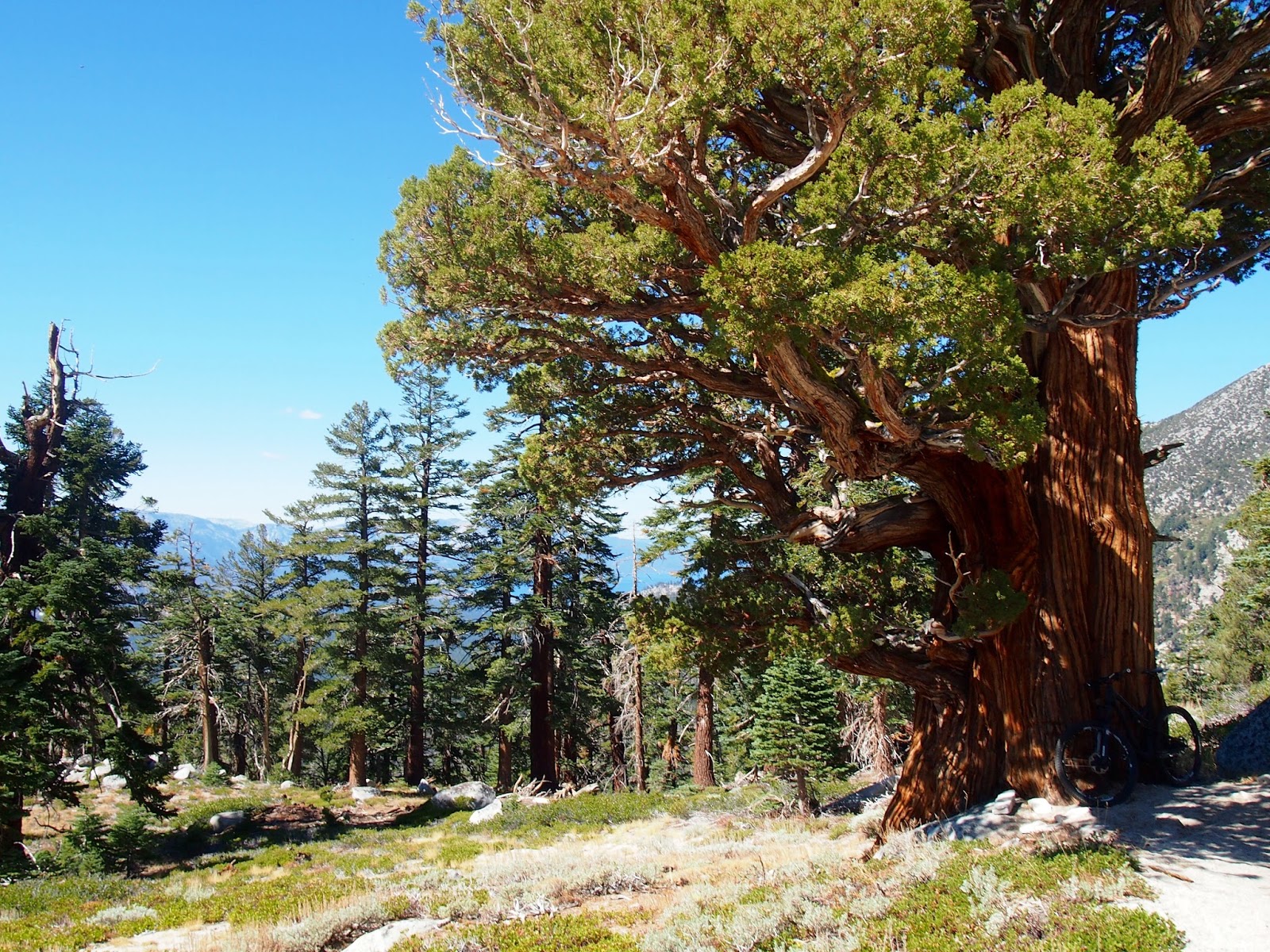
This first loop took us back to where we parked and we continued on the camp road to Manly Gulch trail. I remembered Manly Gulch to be a grueling climb, so we had lunch first, which really paid off especially towards the top portion of this climb. But it was so nice! Technical singletrack, all rideable uphill and very tempting to ride down as well. But our planned route took us west onto Rd 408 close to area called Jiro's Playground. The goal for the day was to ride series of single track trails with names such as Gas Tank - Gas Cap - Fury II and Boiler, some of the best trails in the area. But first we had to find our way through an area marked on the map as "Total Confusion". If you look at a detailed map of the area, you will see why: there are at least three paved or gravel roads all named "Little Lake Rd", and many single track trails parallel these roads and cross them in unexpected angles. We tried to look at our map held upside down, turned 90 degrees left or right, but every decision to go LEFT or RIGHT seemed equally probable. Finally, with the aid of phone OSM maps (cleverly downloaded for offline use by yours truly), we found ourselves on the correct trails. But until then, we rode tons of very fun twisty, rooty and loamy trails while being quite lost and not minding a bit.
Pavel in awe. Boiler Trail
These trails along Rd 720 were the gems of the area. Steep, technical, then flowy with many short uphills and retrogrades to keep the fun factor high. 
 
  
We finished our day soaking wet (it continued to drizzle for most of the day in the woods), but after a hot (!) shower in the camp, we were ready to explore the north coast and the North Coast Brewery.

Cabrillo lighthouse sunset.

 On a bright and sunny Sunday morning, we started our ride along the left bank of Big River, on a flat fire road with excellent views of the river and marshes. It was a good warm-up before the trail pitched steeply up and climbed to an area called Dry Dock. Here, we rode some of the trails along Rd 720 but in opposite direction than on Saturday, while trying new options. This way we found Gas Tank Trail (clearly marked by an old car gas tank), climbed up some corkscrew-like trail not believing we could have ridden it down the day before and again got a little lost in deep fern canyons.
We exited the green jungle and rode on Rd 408 for a short stretch to connect to Ames Lodge trail, a single track that passed through at least three completely different micro environments: starting under redwoods on trail deeply carpeted with tree needles, then coasting on sandy trail through a Pygmy forest and finally a fast downhill through rocky and mossy lush greenery towards the river.

After the ride, we lied down on a fine sand beach at the mouth of Big River, ate leftover pizzas and drank what remaining beers we had. At this point, I really did not feel like getting behind a wheel and driving 200 miles home. What would happen if we just stayed and camped and rode our bikes forever? To make the finale of our trip more interesting, we drove down the coast on highway 1 to Jenner, me enjoying the sharp turns of the road and Pavel enjoying the views.

Sonoma coast near Russian River. There is a completely naked guy running on the beach.
 Ah, California! How nice it was riding with a friend, on superb trails, without the crowds. Looking back at a trip like this will enable me to survive the daily insanity for few more months.

Monday, October 5, 2015

The Punisher

A week ago, in the allergist office, the doctor took the stethoscope out of her ears and said: "You are wheezing. Double up on your inhalers for the next three weeks." For some reason, the fall season transition is always the time I feel my allergies worsen. But after many years of living with it, my threshold for self diagnosis has lowered and it took a medical exam to reveal some sub-clinical inflammation and pulmonary obstruction. The long story short: got too busy at work, called for refills on Friday and got an automated message that my meds will be ready for pickup on Tuesday. So I left for South Lake Tahoe on Friday afternoon hypomedicated, but very much looking forward to ride trails that should be in prime shape after Thursday rains. The forecast called for another front bringing rain into the area on Sunday.

On a cool Saturday morning, I started my ride from the beach in SLT and climbed on Van Sickle trail, over the Nevada state line towards Heavenly ski resort. My plan was to complete the 30 plus mile ride, sometimes called the Punisher (there is also the Uber-Punisher, double the distance), which follows the Tahoe Rim Trail over some high passes and descends from Armstrong Pass back to the lake. Van Sickle is vane sick climb, littered with countless rock step ups, that require lots of oomph to lift the front wheel over. Here I had just enough oomph to do one or two of these steps, then walked the next three, thinking that my heart was about to escape my chest cavity through the esophagus. As I gained altitude, my sickness was getting worse, so as I crossed multiple ski runs, I took the smooth but steep service road to the top. Back on the TRT, the trail cut into several canyons while being perched on a steep slope with quite an exposure.

Skirting the eastern slopes of Monument Peak, views towards Nevada opened up, but as I approached the split with Monument Pass trail at about 8,600 ft, the technical nature of the trail and the lack of oxygen in my blood forced me off the bike. I got to the trail junction, just mere 10 miles into the ride exhausted and dizzy. It took me almost two hours to get here and I knew I should get going but needed some rest and sugar.
I could see the high point of my ride from here - Freel Peak (the bald mountain on the horizon in the photo above) and this perspective just added to my feeling of biting just too much to chew. The trail continued to climb gently but it took lots of effort to keep going, partly also due to loose decomposed granite trail surface.


But it was so beautiful up here! Cool breeze with occasional strong wind gusts, signalling weather change, excellent visibility and total solitude. My plan was to reach Star Lake and decide if to take a shortcut back down on Cold Creek trail. I rode this trail back in May and knew how technical that downhill was. I secretly hoped to have enough energy left for the Armstrong trail down.

Compared to how many people I saw until here, Star Lake was a crowded beach resort. I saw about five bikers here and spoke to couple of women who assured me that the next five miles to Freel Pass was a great trail not to be missed. So after another bar, a short hike a bike that (again) spiked my heart rate to some triple digit number, I continued south and up towards a saddle below Freel Peak.

I crossed the saddle at 9,800 ft and did not linger around here. The wind was howling. I just saw a rider ahead of me to put his body armor on and then I dropped the seat and picked up speed. In my oxygen depleted brain, it took a while to register that I was actually on quite a technical downhill. I somehow expected the trail to continue climbing towards Armstrong Pass, which is actually at 8,700 ft. The top part of this downhill followed the barren landscape in large switchbacks, often over boulders and with shifting coarse sand under the tires, requiring lots of attention. I rode this section in half dazed state, which was probably good, since I was loose and not afraid. Funny, when I think back, I completely assumed it was safe to ride all drops at speed, letting the bike to handle the rough stuff. Or perhaps it was all my imagination and I actually rode slow while being dumbed down?

One way or another, I "woke up" when my wheels hit the loamy dirt and rock of the perfect Armstrong trail. To ride here without enjoying every millisecond of it would be a waste of time. This trail flows, jumps, has few scary spots requiring commitment but mostly it is enormous fun. The next section was Armstrong Connector trail, here the riding got really technical, with more than a few spots where a trail "feature" suddenly appeared forcing me to stop and convince myself to walk back and ride it, or scramble and slide down rock faces covered in that coarse grained granite sand on foot. I finished the 10 mile descent on Corral and Sidewinder trails, getting dizzy again on Sidewinder, not from altitude but from the fact that this trail literally folds upon itself and looking ahead means seeing three switchbacks down the hill, unless they happen to be hiding behind tall berms. Sorry, no pictures from this part of the ride: go on YouTube and understand why stopping for pictures was not an option.

I reached the valley still high on adrenaline, called Marketa to be about an hour late and rode back to where I started on the last, eight mile long trail connectors. At this point, I was out of water, out of glycogen and out of any residual strength in my legs. There was still climbing to be done and I stood up and pushed the pedals, thinking that this was it, I was never ever going to finish this ride on these park like trails. A mile from the hotel room, food, water and warm shower, I hit 42 mph coming down Ski Run Blvd, just before stopping at an intersection with Lake Tahoe Boulevard, with continuous stream of traffic. A mile of street between the trail head and the main road divided the two worlds. This ride was a nicely punishing way to close the riding season at Tahoe.