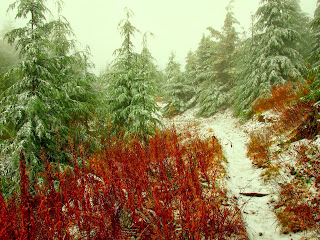
The town of Anacortes is on Fidalgo Island, but you can drive there. The ever useful evergreen Wiki site gives all details about the Anacortes Community Forest Lands (ACFL), including detailed trail map links. There are three general areas that can be connected into one epic ride. I asked about the trails in a local bike shop and was told "some are somewhat technical." I started at Cranberry Lake and no kidding, the first trail I hit was indeed technical. Lots of transverse roots and rocks, including large granite slabs and rocky step ups and drop offs. These trails were much more Campbell River than Issaquah.
I rode in a clover leaf pattern around the lake, either climbing with my chest on the handlebars or descending with my ass hanging over the rear tire. After getting a blister on my palm, I headed south and connected with the Heart Lake area.
I followed increasingly technical and steep single track along Heart Lake Road, until my legs just gave out. This happen to be on a moss covered rocky outcropping, a great place for lunch.
I did not even attempt to continue further towards Whistle Lake, just look at the trail map, it is dizzying. On the way back, I tried to take other trails for variety and stumbled upon trails 109 and 129. These trails were real gems. Back at the lake, my Garmin showed measly 13.5 miles and 2:05 hrs. Now, I know I rode for about 4 hours and with the exception for perhaps 20 minute lunch break, I rode non-stop. My legs felt like after 20 miles. I have a suspicion that after the latest firmware update, my little GPS is cheating on me!
 |
| Bigfoot's mushroom garden |
Next morning, I was the first car in a ferry line to Orcas, just before sunrise. From the Orcas Island ferry terminal, it took just 25 minutes to reach Moran State park. My plan was to follow this description of a ride to the summit of Mt. Constitution, the highest point of San Juan islands. The ride starts with a brutal climb. No warm-up. The first switchback threw me off bike. Then I climbed some more, then I hiked 50 meters and rode 50 meters. Then hiked some more.
At some altitude, I have crossed the zero isotherm and trail surface became frozen, with ice slabs filling spaces between rocks and frozen mud mixed with large ice crystals. The upper part of the climb was less steep and I was also out of the deep woods, riding in a pine forest with bald, rocky and sunny spots. As I finally reached the view tower, after about 2 hours of climbing, my GPS read 33 minutes!
Damned be the technology, the view was worth it! I bathed in the morning sun and enjoyed the far far views - Canadian Rockies, Mt. Baker, the whole archipelago, Olympic range, even the tip of Mt. Rainier above the horizon.
Descending back to the saddle on the icy trail was more enjoyable than climbing it, but then, after Cold Springs, a real treat of the day awaited. Flowy, soft ribbon of single track, just steep down to make it interesting and not overheating the brakes, with occasional short climbs.
 |
| Who's got better late November singletrack? CT, CA? Revelstoke, BC? |
The overall downhill part of the ride was peppered with short, punchy climbs, where lofting the front wheel over thick roots and rocks was becoming progressively more tiresome. The final stretch of trail along the Cascade Lake was the last drop, but I drank it all.
A late afternoon ferry ride back to mainland, after drinking lots of coffee and eating one of each of the pastries on display at the ferry village.
Those truncated GPS tracks are here and here, more pictures here.


