Tuesday, September 4, 2012

Kalalau Trail

I had first heard about the Kalalau trail on the island of Kauai, HI in 2003 during our first visit to Kauai. That year, we hiked the first 2 miles of the trail to Hanakapiai beach, as many tourists do, wearing sneakers. It was wet and our sneakers ended up in a garbage can after the hike. But our appetite to hike the 11 mile long trail along Na Pali coast out and back, was whetted.

So we were back a year later, this time equipped with heavy duty hiking gore-tex boots, backpacks, sleeping pads and bags, a tent, stove, dried meals, camelbaks and water filters etc etc.


 It rained, because it always rains in Kauai, the trail was wet, muddy, slippery, rutted, steep and rocky. It took us eleven hours to reach the Kalalau Beach, so the pace was 1mph. The beach at the trail's end was worth all the effort.



It rained some more on our way back the next day and I remember being pretty desperate about my wet boots, socks and blistered feet. Water got inside my boots not from walking through the mud puddles, but from the top, flowing alongside my legs in rain and every time I dragged my legs through wet vegetation. It was a tough hike. We realized we overpacked a lot and decided that one day, we will be back one day for a fast, minimalist overnight hike.

That day almost happened to be this past weekend. I say almost, because the original plan was quite different: Marketa flew to Kauai to run her third Kauai marathon (and her third this year). But a plane-acquired virus got a hold of her and her taper leisure 5 mile run a week before the marathon weekend ended up in projectile vomiting all over the lush island vegetation. Next, she ended up in bed with a high fever. So I packed all light hiking accessories and went to Kauai hoping that if running a marathon was out of question, the Kalalau trail would be an easier substitute when she got a bit better. By Saturday, it was clear that the virus was a vicious one and plans had to be modified again. We decided on me testing the light hike version and gear by allowing myself about seven hours for the hike and to see how far I would get in 3.5 hours before turning back.

Despite wearing the same T-shirt and shorts as eight years ago (yes, the Patagonia gear is indestructible), I carried a Camelbak with 3 liters, a filter, first aid kit, an emergency headlight, and three power bars. Most importantly, I had put on my trail running Adidas shoes, running socks, and insulated my feet with waterproof gaiters. I also carries spare socks in a ziplock bag as well as thin neoprene socks.

I started the hike at 7:40 at the newly improved trail head, equipped with maps and many signs with long lists of all activities and behaviors prohibited. The first section of the trail was improved hugely, with water bars etc., but it is still very steep and rocky.

Despite lots of rain the previous week, the trail was completely dry and the first 2 miles to Hanakapiai was a breeze, arriving at the beach in 40 minutes.


This is as far as 99% of the tourists would go. From here, the trail gets considerably more technical and prone to turning to a muddy trough after each rain shower. I was very lucky, few drops here and there, but weather stayed mostly dry. So I jogged wherever the surface and my lungs allowed and tried to use my brain to think about three steps ahead on wet rocky sections. Traction of my shoes was near perfect on all but the slickest rocks, but after a while, I got used to slight sliding of soles on rocks upon each step. I arrived at the camp at mile 6 in Hanakoa Valley after another two hours, soaked with sweat but with dry feet. Here, instead of continuing for another mile or two, I decided to search for a side trail leading to Hanakoa Falls. After two unsuccessful attempts of hiking up overgrown stream beds to impenetrable jungle, and asking passing hikers (blank stares...), I finally identified the trail using a trail map picture I took at the start.

 This half mile trail followed a stream pretty much all the way to kind of an anemic waterfall (9/5 update: searching the web for Hanakoa Falls pictures I  found that the waterfall I reached indeed was not the 1000 ft high Hanakoa, so it means I got lost somewhere along the way):

The search for trails and waterfall hike took me an hour and my shoes and socks were completely soaked by now. So for crossing the Hanakoa stream on the way back, I put the neoprene socks on. Good idea, as I got going, it started to pour and heavy rain came in sheets. I took this lo-res video which may look like walking among your grandma's flower beds in a sprinkle...


Back at Hanakopiai beach, the weather improved, so after crossing the stream knee deep, I pushed myself to a trot, scrambled up steep switchbacks and actually ran on rocky down slopes back to Ke'e beach.
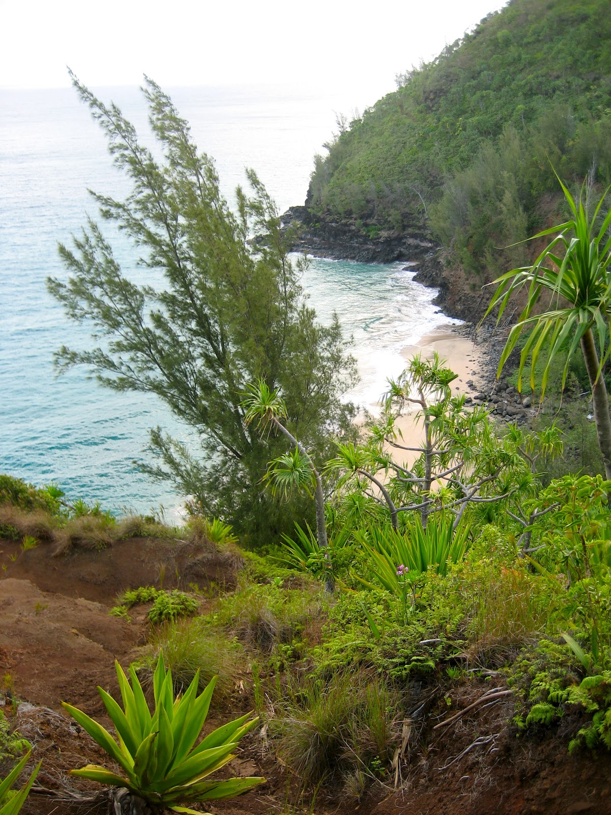
I was back at the trail head at 1:15, after 5 hours and 45 minutes and about 7 miles. So it looks like this way of traveling along the KT is the way to go, for an overnight hike I would need a hammock or a light bivy and little more food. Good grippy sole on your shoes is the most important factor, in my opinion, and the neoprene socks worked wonderfully, saving one the need of dangerous scrambling over slick rocks while crossing streams, or changing into tabis or water sandals.

The silver lining on this trip for Marketa was that we were able to convince the race officials to roll her marathon entry to 2013! That means, we will be back, and if all goes as planned... check back here in a year. The Na Pali cliffs will certainly still be there.

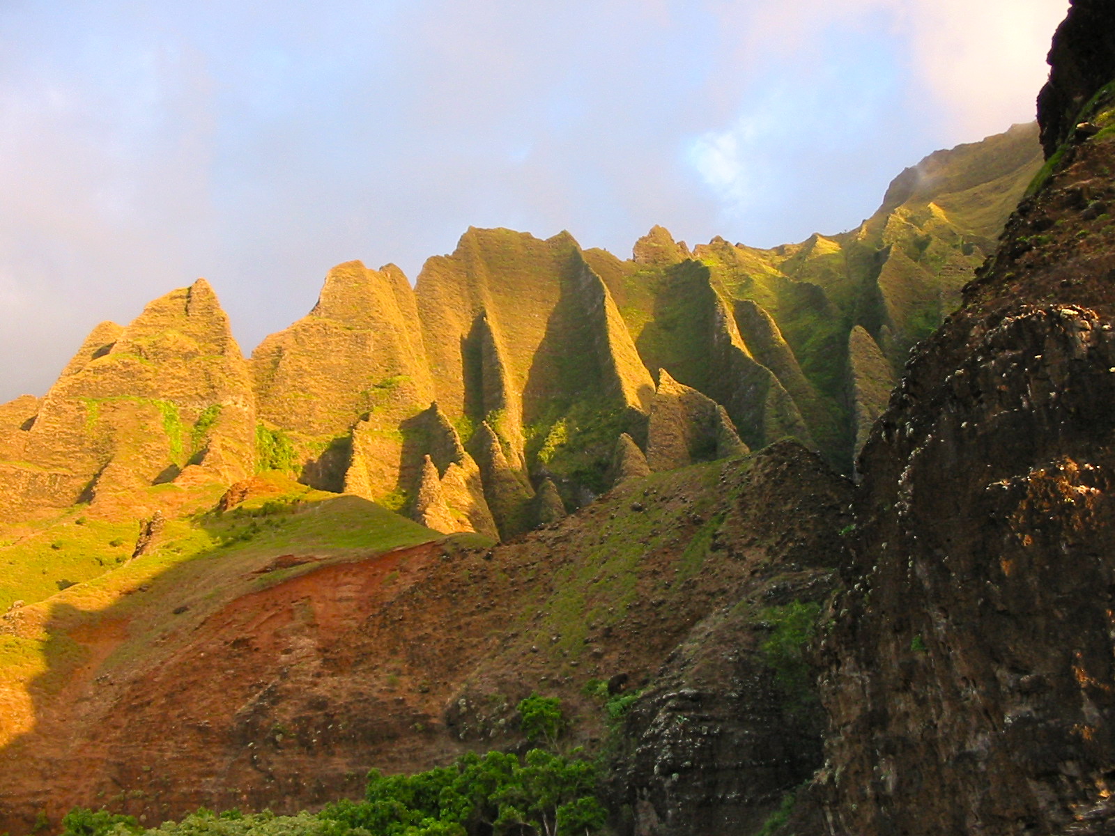
Na Pali coast as viewed from our helicopter flight on Monday 9/3


Wednesday, August 15, 2012

Scouting out Sierra Buttes trails

Having barely survived a tough bike ride on a hot day last week, we took off for a four day camping trip in the Gold Country, with the goal of exploring trails around Downieville, Sierra Buttes and Lakes Basin. I did not bring a bike with me, Marketa and I wanted to hike and run some of the trails together.
Equipped with a detailed and indestructible tyvek map of the area, purchased at the Yuba Expeditions bike shop, we realized there were numerous 4WD dirt roads, multiuse (hike, horse, bike, quad) trails and hike / bike singletracks. The whole trail system is maintained by the Sierra Buttes Trail Stewardship. It seems that the local guys have figured out how to make all users happy on these trails in the Tahoe National forest.
Our first destination were Tamarack Lakes on Sardine Lake overlook trail. Seven miles round trip seemed easy enough to have plenty of time either to continue onto the Sierra Buttes Lookout at 8,597 ft, or for a swim in one of the lakes. Altitude, temperature in the high nineties, underestimating the amount of water needed and very loose trail surface made this hike a tiresome affair. We slogged along the steep, loose and exposed trail in a semi-dehydrated state at a snail's pace. The trail is very steep at places, the surface is never firm, mostly consisting of loose rocks of all sizes and shapes.


Tire tracks indicated it can be ridden, but my guess is as a one way downhill from Packer Saddle, and would be very technical, but the views of Sardine lakes were fantastic.

A late day swim in Sand Pond (an old gold mining "tailings" pit, probably full of arsenic and cyanide) cooled our dusty and overheated bodies.

Reaching the watchtower at the Sierra Buttes summit had to be postponed for the next day. It was even hotter, but this time we carried 6 liters of liquids, for another hike just six miles long and about 2000 feet elevation. Trudging slowly up a jeep road from Packer Lake, we joked that such distance and elevation is what we would normally run on trails in our neighborhood, never considering it hard. Yet here it seemed very hard, mainly I think because there was never a firm footing to be found on steep grades.

We crossed the Pacific Crest Trail and continued up. At one trail intersection, we found bunch of 4WD vehicles, ranging from pickup trucks to all decked out Toyota FJs, with their adventurous drivers sitting in camp chairs and drinking beer. But the singletrack trail turned into a boulder field, forget about riding here.

Another stretch of a jeep road took us to the rocky summit, where steep ladders over gaps let you climb up the lookout.

The descent felt easier and this time, there was enough time and energy left to first get an ice cold German beer at the Packer Saddle Lodge, then jump into beautiful Packer Lake, and finally take some rest at the lake shore.


The third day of hiking took us to the Lakes Basin area. We started out on a beautiful, but for biking, very technical Grassy Lake trail along lovely waterfalls and reached Long Lake, a real jewel.


As during the previous couple of days, we did not see any mountain bikers on these trails and very few hikers. I saw some tire tracks on Long lake Connector trail, meaning it is rideable, but in my assessment and knowing my skills, I could imagine this would be a slow, technical and unforgiving ride, with lots of rocky drops and a constant lifting of the front wheel over obstacles.


Our planned afternoon of swimming in Long Lake was rudely interrupted by a sudden thunderstorm, which had formed within minutes from a few innocently looking cumulus clouds.


Since the weather forced us off the mountains early, we had plenty of time to stop in Davis on the way home, to enjoy some tasty Czech food and wine in Little Prague restaurant despite the evening 100F temperature.
In conclusion, it seems that trails marked as green dashed lines on the Yuba Expeditions map are much more suitable for mountain biking, the red marked trails are super technical and would likely include lots of hike a bike. Using the shuttle service from Downieville to Packer Saddle and riding the famous Butcher Ranch, Pauley Creek and Divide trails back to town is probably the best option to taste these trails. Numerous other rides are surely possible by combining the jeep roads and singletracks, although none would be very easy, that I am sure of. The whole area is very scenic and not very populated, making it a paradise for outdoor sports, as the few who live here must have discovered.


Friday, August 3, 2012

Hear, hear!

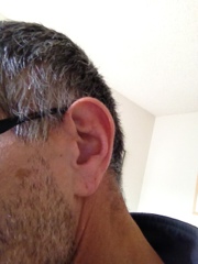
I don't demand attention by this post (would that be Blog, blog!)? I want to touch upon the topic of hearing well and listening to music while biking or running. On a bike, at least on roads, I would never plug my ears with earphones blasting loud music. This works great on a stationary trainer, but could be rather deadly on the road. Actually, it is increasingly dangerous for me to ride even with my ears unplugged. The reason for me hearing approaching cars at the last second is a hereditary hearing loss. Until recently, I have been using a sophisticated hearing aid of the so called open fit / behind the ear design. It works great at work, but due to the microphone location on the main device body, which is positioned behind your ear lobe, it is very sensitive to wind noise. Forget about wearing it on your bike. There are custom fitted hearing aids that sit in your ear canal but so far, these have been very expensive. For the last couple of weeks, I have been trying a new product by Starkey Laboratories, called AMP. These hearing aids are programmable for mild to moderate hearing loss and come in three sizes to fit your ears.

and a nice case with the magnetic wand, used to control the settings, included.


Since sound is delivered naturally through your ear lobe and canal, wind noise is not over-amplified. I tried my new bionic ears in one 40 mile road ride and they worked great: every approaching car scared the hell out of me, all of a sudden I heard every little creak of my cranks and pedals, and every shift made me almost jump off my bike. Sweating and moving my jaw when drinking did not loosen the fit and the AMPs stay where they are supposed to. Plus the benefit is that they are almost invisible off the bike.


Now as far as running goes, I would not mind tuning the whole world out and listen to a good rhythm. Many runners do, and of course, this drives us bicyclists crazy when we pass them, yelling "on your left!" to no avail. In running, my problem has not been hearing well, but rather keeping the earphones in my ears. Every type and brand I tried so far would fall out after a short time, including the plug types. During a recent visit to REI, I filled out a sweepstakes entry form and I won! A pair of Yurbuds. They sure look cool with the red Mylar cord but esthetics don't matter much if you end up with your buds dangling over your shoulders after a quarter mile on trails. The Twist Lock shells claim to stay in your ears while jumping off rocks during a category 7 earthquake, and so far they passed the stairs-jumping test at home. A trail report will hopefully follow soon, as soon as my quads recover from the pavement induced beating of the San Francisco half marathon.

Monday, July 30, 2012

Running in San Francisco

Sunday July 29 was the International San Francisco marathon. Both Marketa (full marathon) and I (second half marathon) participated in the race. Neither of us really trained for it, we had signed up in the winter months when it seemed like a "fun" idea to run in the city among thousands of other people. Both of us have been running mostly on trails lately, putting in decent mileages, so we did not think about this event as anything exceptionally hard.
The logistics of the SF marathon are difficult: packet pickup one or two days before means dealing with the crowds and lack of parking. The race day was even harder: I dropped Marketa off at the Ferry Building start at 6AM, then drove to the Golden Gate park to leave the car at the underground garage (supposed to open at 6AM according to the website, in fact opening at 7AM) to get to the 2nd Half start line at Spreckels Lake.


Al least, there were enough port-a-potties here, although the line was endless. The full marathon area was even worse, with many restrooms not easily visible from the start and no clear instructions.


Then of course, there is the weather to deal with. Many hot weather states (AZ, TX) have marathons in the winter, which in my opinion should also be the case for SF. One of the attractions of running in SF is supposed to be the views of the city. In a dense morning fog, there are no views from the Golden Gate bridge. Fifty degrees Fahrenheit is supposed to be an ideal long distance running temperature, but drizzle and humidity makes it feel even colder, at least to me. The fog did not break even on the usually sunny Embarcadero site of the town at the finish line, until noon, so the Mylar blankets were used by many finishers, who kept shivering in the fenced off area, standing in long and slow lines after getting their race medals.


We both finished and both of us actually enjoyed our runs, simply because it feels nice to be running. OK, it did not feel that nice when I started to cramp after mile 8 on a steep downhill, and Marketa did not take her arm warmers and gloves off for the whole foggy run, but there was a sense of accomplishment for sure, when we met in the finish area.


I chose the 2nd half marathon because Marketa and I finished within a short time from each other and could meet at the finish. I was also looking forward to running around the Golden Gate park, which is beautiful, even on a gloomy and drizzly morning. I was curious about the famous Haight Street, but frankly, I was disappointed. Mostly by the terrible street surface, which had me looking down not to trip in potholes, but whenever I looked up, you see poles and wires, like in this image snatched off from Wikipedia:


I am sure to many people this is just a part of the neighborhood's character, but I cannot help myself but think that it reminds me of New Delhi more than a modern American metropolis. The next part of town along the course, between Mission St. and Mission Bay was really bad, I would not come here by myself at night. Mission Bay is one huge construction site these days, with the new UCSF campus and many biotechs finding a new home here.


The new buildings are very modern, but the huge structures of concrete and glass made me feel small and lost. So from a neighborhood which looks like it was built by bums to a socialist style opulence. I think I would take the newly yuppie-zed Czech suburbs...

...or a historical Italian town


....over SF. So to finish my negative blog post on a negative note: Sorry Frisco, I am not coming back to run or bike your streets again!


Tuesday, July 24, 2012

Dual Eyeware Sunglasses - First Impression

Getting older is mostly fun, but sometimes it may be less fun for people around me. During the California road trip, my friend John realized that I had trouble seeing the map details as well as the numbers on my computer, when I wore contact lenses, and he got tired answering my "are we almost there?" questions. I am short-sighted and I have been using contacts for sports for a long time. With age, a weird form of long-sightedness creeps up, but disappointingly it adds onto my primary vision impairment, and does not seem to even it out. See, I normally wear progressive multifocal glasses, but they can't make that gradient of power with contacts.
John has recently pointed me to a company who makes bifocal cycling sunglasses. You can buy them online, but I did not know how much power I needed to compensate my contacts to see better at the handlebar distance. I found couple of bike shops in Santa Cruz listed as dealers, called to confirm they had the glasses in stock, and set out for a road ride on Sunday starting near Skeggs preserve on Star Hill Road towards Santa Cruz. The ride itself was beautiful, I was riding on the fog edge, alternating between warm and sunny and cool coastal micro environments. The plan worked, I bought the $50 glasses with the +2.0 strength and gave them a first test on a Monday ride.

I like the shape and the wrap-around style, as well as the brown lens color (also come in grey). Ventilation is just so so, compared to my old Oakleys, and the nose pads are not adjustable. But the main point, using the bottom part of the lens to look down on your phone, cycling computer or a map worked great!


There is a problem, though and I will see if I get used to this: when clipping into my right pedal from standing, I like to do a quick visual check. With the glasses, the shoe and pedal are a blur. Next, while riding, I also like to perform quick visual checks on what gear I'm in (none of my bikes have gear indicators), again, looking down on your chain rings or cassette, you get a blurry image. Tilting your head way down to use the upper part of the lenses solves this issue, but I am sure this will take a little getting used to. So far, I take the advantages over this little inconvenience, and for fifty bucks I will be able to finally see how fast I ride :-)

Diversity

You often hear people who live in the San Francisco Bay Area say how diverse this place is. It may mean different things to different folks, but if you look at the population, cultures, geography, nature and many other things, you'd have to agree. To me, the most evident diversity is in natural environments, weather, trails and the fact that you may encounter wildlife forms just outside of urban sprawls and industrial complexes.
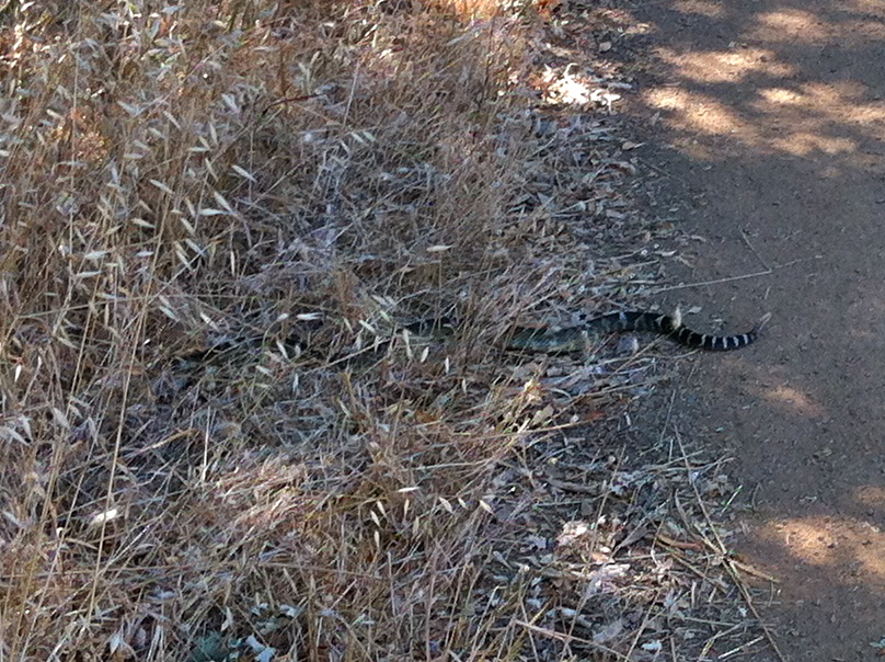
The Saturday ride with my friend Pavel was a good example. It was a hot day, even the Belmont Blow cooling fan was not working, so we went to ride trails around the Steven's canyon, Montebello and Skyline Ridge. Taking a rest at the intersection of Canyon Trail and Bella Vista trail, Pavel noticed a movement in grass on the trail side. A big rattlesnake was sliding down the hillside towards our bikes. It went slow, its head up and an S-coil ready to strike at something just in case. We stepped away, but the snake must have sensed us, pausing along its way and moving its head side to side. Then it slid through the spokes of my rear wheel! I was so fascinated by the animal that I got my phone camera out too late, by then the rattler was almost gone in grass. For the rest of the ride, I kept scanning the trail ahead for snakes.